
The protected strip is in the contract. The tractor has not read it.
A dune system no vehicle may enter, an internal road at a solar plant limited to 20 km/h, an irrigation channel bank that is not cleared during the breeding season. The rules exist, and they are almost always in a PDF. What is missing is knowing whether they are being followed without sending someone to watch.
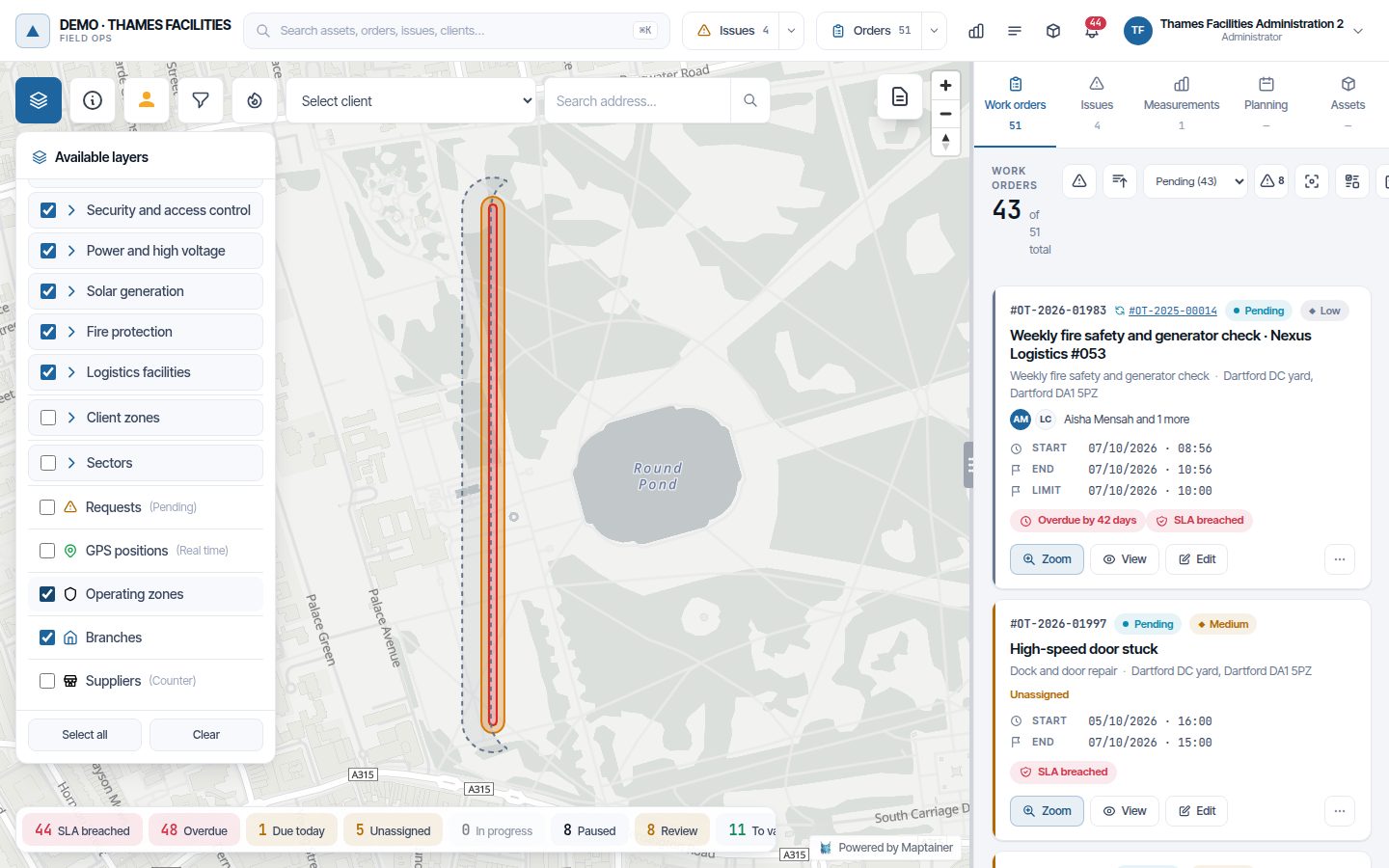
Operating zones are areas of the map with rules. Maptainer compares every position arriving from vehicle GPS or staff phones with them and, when someone enters where they should not or goes faster than allowed, records it with its track. They are included at no cost: the company administrator switches them on.
What stops happening to you.
- You stop finding out from the complaint. An entry into a no-go zone raises an alert at once and opens an incident, with who it was, when they entered, when they left and which way they went.
- You stop planning work where it should not happen. The planner warns about a work order, or refuses to save it, if it falls in a zone and on a date when that work is not allowed.
- You stop justifying the monitoring with words. Every week is reviewed and signed off by the supervisor, and the compliance report is emailed automatically, including to recipients outside the company.
- You stop ignoring alerts because most of them are false. A GPS jump does not end up as an incident. The filters are designed so that an alert is worth looking at.
Three rules, each with its own season.
A zone is drawn as a polygon or generated as a strip at a set distance from a line: you trace the foot of a dune, the edge of a road or the centreline of a right of way, and set the metres the strip runs from and to. The same line can produce two zones, for example 0 to 5 m with no entry for vehicles and 5 to 15 m with a speed limit. To draw over the aerial photo you can use the orthophoto or the WMS layers the company already uses.
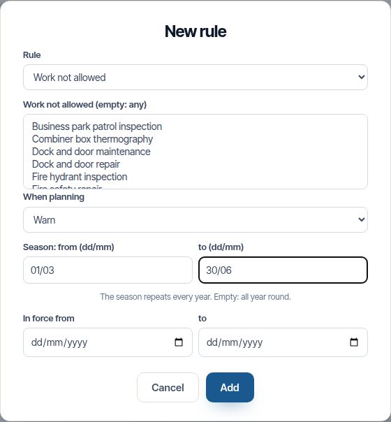
Each rule says who it applies to — vehicles, staff or both — and when it is in force: all year, between two dates or in a season that repeats every year, such as from 1 March to 30 June.
| Rule | What it detects | What it does by default |
|---|---|---|
| No entry | A vehicle or a person inside the zone | An alert and an incident for each incursion |
| Maximum speed | Speed above the limit plus its tolerance | Alert only: the supervisor reviews it on the track |
| Work not allowed | A work order planned in the zone on that date | An alert, or refusing to save it |
A GPS jump must not end up as an incident.
A phone or vehicle GPS sometimes jumps by tens of metres. If every jump opens an incident, by the third week nobody looks at the alerts. That is why detection is deliberately conservative:
- Minimum accuracy Positions with more than 50 m of error do not count.
- Several positions in a row Two inside a no-go zone for an entry to count, three above the limit for speeding.
- Impossible jumps If reaching a position would require travelling faster than 160 km/h, it is discarded.
- Speed measured by the GPS Not the speed obtained by dividing the distance between two points, which is exactly what a jump inflates.
- One incursion per vehicle If the vehicle has its own GPS, whoever is inside does not count twice.
- Late arrivals A tractor without coverage stores its positions and sends them when it gets signal back. The incursion is recorded all the same; if it arrives more than 24 hours late, it is left for review without opening an incident.
All these thresholds can be changed in the zone settings.
A nest found closes off its surroundings while it stays open.
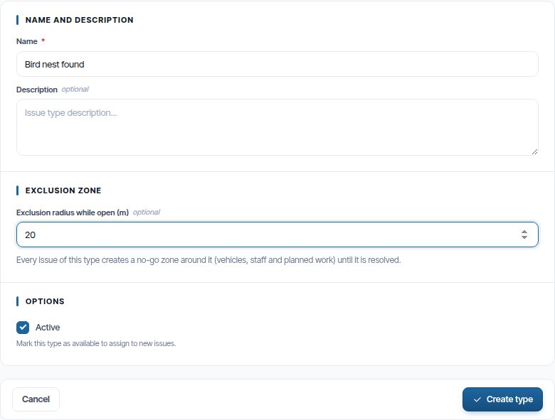
An incident type can carry an exclusion radius. When someone reports, for example, a nest found from the app, a no-go zone for vehicles, staff and planned work is created around it. The zone disappears automatically when the incident is resolved, closed or rejected.
It is how a finding in the field — a nest, an unstable slope, a spill — protects the site from that moment on, without waiting for someone in the office to draw a zone.
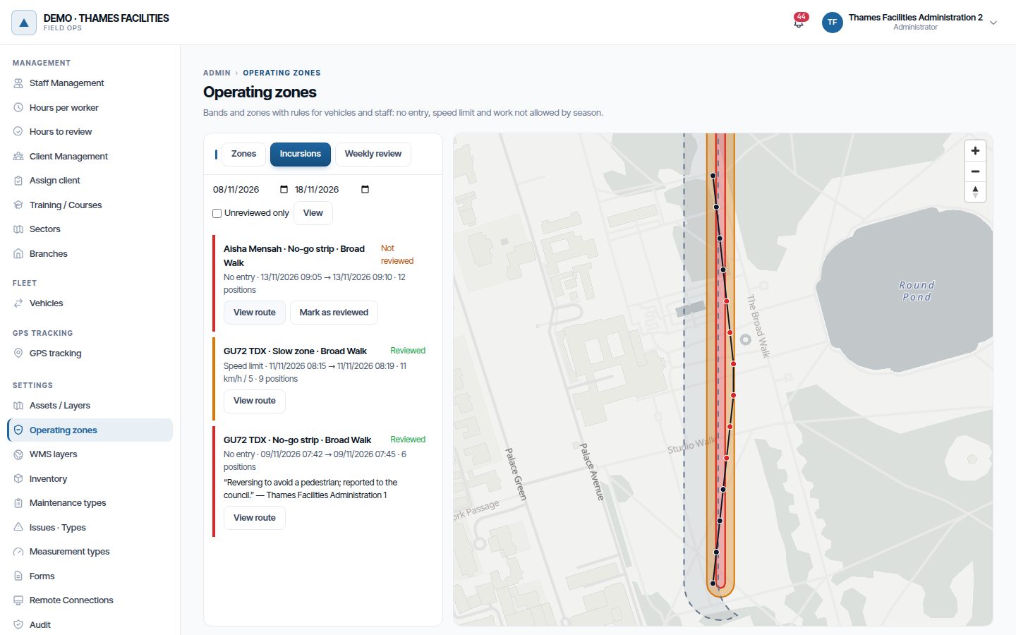
Every incursion with its track. Every week reviewed.
An incursion stores who, in which zone, from when to when and at what top speed. From the list you can see the track on the map — before, during in red and after — open the incident it created and mark it as reviewed with a note.
The weekly review summarises the previous week: incursions, prohibited entries, speeding, those still unreviewed and those with an incident. The supervisor signs the week off even if there were none, and who did it and when is recorded. The Operating zones compliance report is scheduled from the dashboard and arrives as a PDF with the summary, the review and the list of incursions.
Monitoring needs positions. Planning does not.
The app receives the zones in force for the day, draws them on its map and alerts the technician when they get close. Permissions separate who can see the zones, who creates them and changes their rules, and who reviews incursions.
| To monitor | What you need |
|---|---|
| Vehicles | Fleet and costs, with vehicle GPS |
| Staff | Real-time field, with tracking from the phone |
| Planning only (work not allowed) | Nothing else |
How to set it up, step by step: Operating zones manual. Where the positions come from: Fleet and costs and Real-time field. And the concept, in the glossary: what geofencing is.
Frequently asked questions
Are operating zones paid for separately?
Does a person walking along the strip trigger an incident?
Does the system stop the vehicle or lock the app?
Can a zone be deleted?
Last updated:
The positions that the zones monitor come from the field.
From vehicle GPS or from the team's phones, with their consent and within their working hours.