
Introduction
Maptainer compares every position that arrives with the zones in force. Positions come from vehicle GPS (see Vehicle GPS) and from staff phones (see Fleet and GPS tracking). When someone enters where they should not, or goes faster than allowed, an incursion is recorded with its track, an alert is raised and, if the rule says so, an issue is opened.
| Concept | What it is |
|---|---|
| Zone | An area of the map. It is drawn, or created as a band at a distance from a line (the toe of a dune, the edge of a road) |
| Rule | What is not allowed in the zone: entering, going over a speed or doing certain work |
| Season | The dates when the rule is in force. It repeats every year (1 March to 30 June) or runs between two specific dates |
| Incursion | What the GPS detected: who, in which zone, from when to when and the highest speed |
| Review | The foreman's record that an incursion, or a whole week, has been checked |
| Rule | What it detects | What it does by default |
|---|---|---|
| No entry | A vehicle or a person inside the zone | Alert and an issue for every incursion |
| Speed limit | Speed above the limit plus the tolerance | Alert only: the foreman reviews it |
| Work not allowed | A work order planned in the zone on that date | Alert, or block saving it |
How false alerts are avoided
Phone and vehicle GPS sometimes jump tens of metres. So that a jump does not end up as an issue:
- Speed is the one measured by the GPS itself, not the one obtained by dividing the distance between two positions.
- Inaccurate positions do not count. By default, those with more than 50 m of error.
- Several positions in a row are needed: two inside a no-go zone, three above the speed limit.
- An impossible jump is discarded. If reaching a position needs more than 160 km/h, it does not count.
- Speeding only raises an alert. A person checks it on the track before opening an issue.
- Someone inside their vehicle does not count twice. If the vehicle has its own GPS, the incursion belongs to the vehicle.
These thresholds are changed in Settings (see Zone settings).
Prerequisites
Turning them on
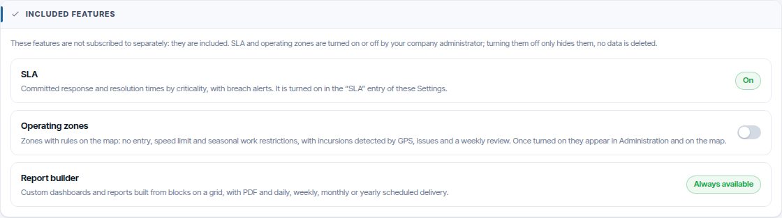
Operating zones are included: they are not subscribed to. The company administrator turns them on in Settings → Modules and features → Included features → Operating zones (see Tenant administration). Once on, Operating zones appears in the administration menu and its layer on the map; when turned off they are no longer monitored or shown, but the zones, their rules and the incursions are kept.
Position sources
To detect incursions at least one source of positions is needed:
| To watch | What is needed |
|---|---|
| Vehicles | Fleet control, with GPS in the vehicles |
| Staff | Staff tracking |
| Planning only (work not allowed) | Nothing else |
Permissions
Permissions are managed in Roles and Permissions. Roles are explained in Tenant administration.
| Group and permission | What it allows |
|---|---|
| Operating zones · View | See the zones, the map layer and the incursions |
| Operating zones · Manage | Create and change zones, rules and settings |
| Operating zones · Review | Mark incursions as reviewed and mark a week as reviewed |
| Alerts · Zones | Receive zone alerts in the bell |
Creating a zone
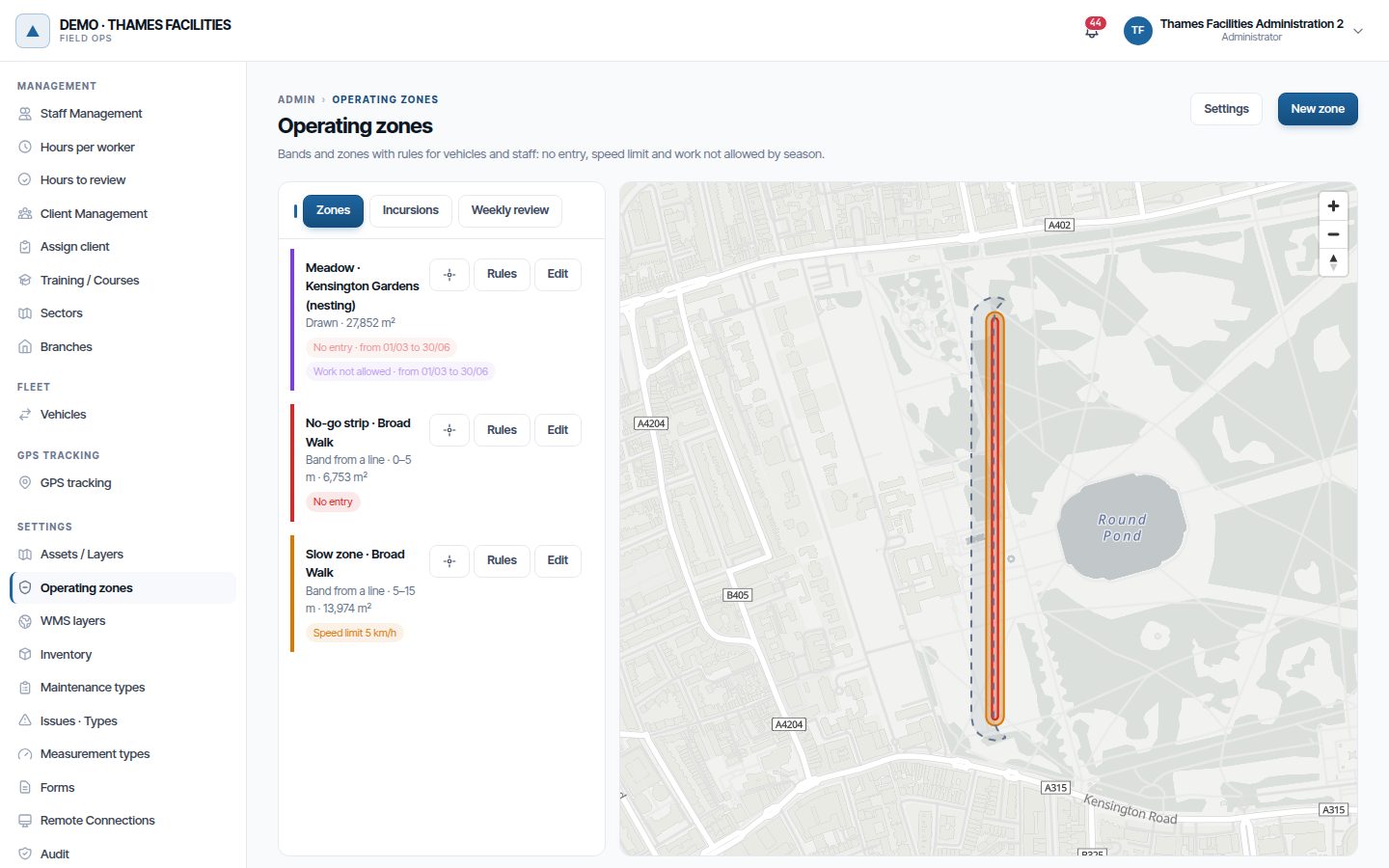
- In the administration area, click Operating zones.
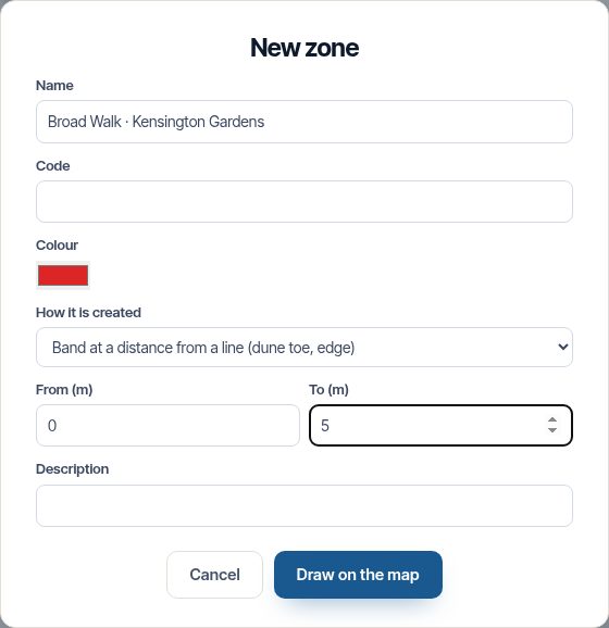
- Click New zone. Enter the name and choose the colour.
- In How it is created, choose: - Draw the polygon, for a free-form zone. - Band at a distance from a line, for a band parallel to an edge. Enter From and To in metres.
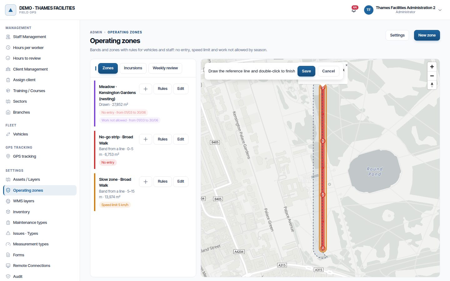
- Click Draw on the map and draw the polygon or the line. Double-click to finish. To draw over the aerial photo, tick it in Background layers, at the bottom left of the map: it lists your company's WMS layers or, if there are none, the PNOA aerial imagery from the IGN (Spain).
- Click Save. The zone's rules window opens.
Example: dune protection
Draw the toe of the dune as a line twice. The first one, with a 0 to 5 m band, is the No entry zone for vehicles. The second one, from 5 to 15 m, is the Speed limit zone at 5 km/h.
Rules of a zone
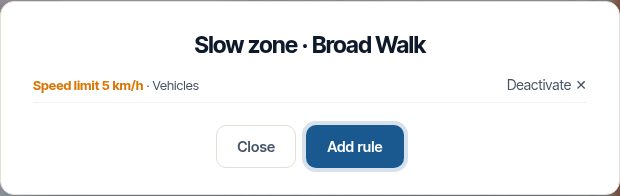
- In the list of zones, click Rules.
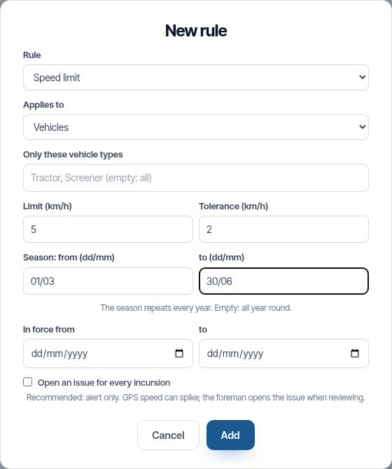
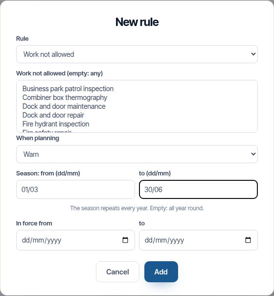
- Click Add rule and choose the type.
- Fill in what it asks for: - Applies to: vehicles, staff or both. With Only these vehicle types you narrow it to tractors or screeners. - Limit and Tolerance, in km/h, for speed. - Work not allowed and When planning (alert or block), for work. - Season, in day/month format, or In force from and to. - Open an issue for every incursion.
- Click Add.
A rule with recorded incursions is not deleted: it is deactivated, so that the evidence is not lost.
Zones that come from an issue
An issue type can have an Exclusion radius while open. Every issue of that type creates a no-go zone around it for vehicles, staff and planned work. The zone is removed on its own when the issue is resolved, closed or rejected.
- In the administration area, open Issue types and edit the type, for example Bird nest found.
- In Exclusion zone, enter the radius in metres, for example 20.
- Save.
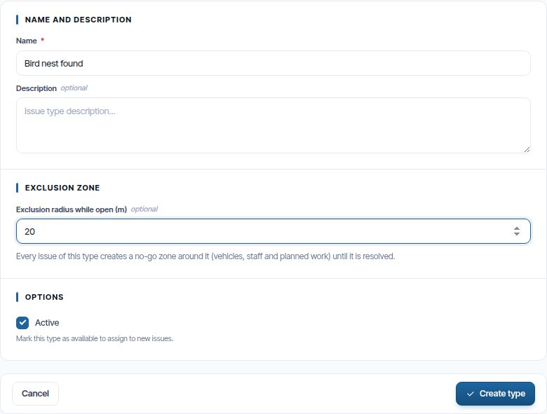
From then on, whoever finds a nest reports it from the app and the zone appears on everyone's map.
Zones on the map
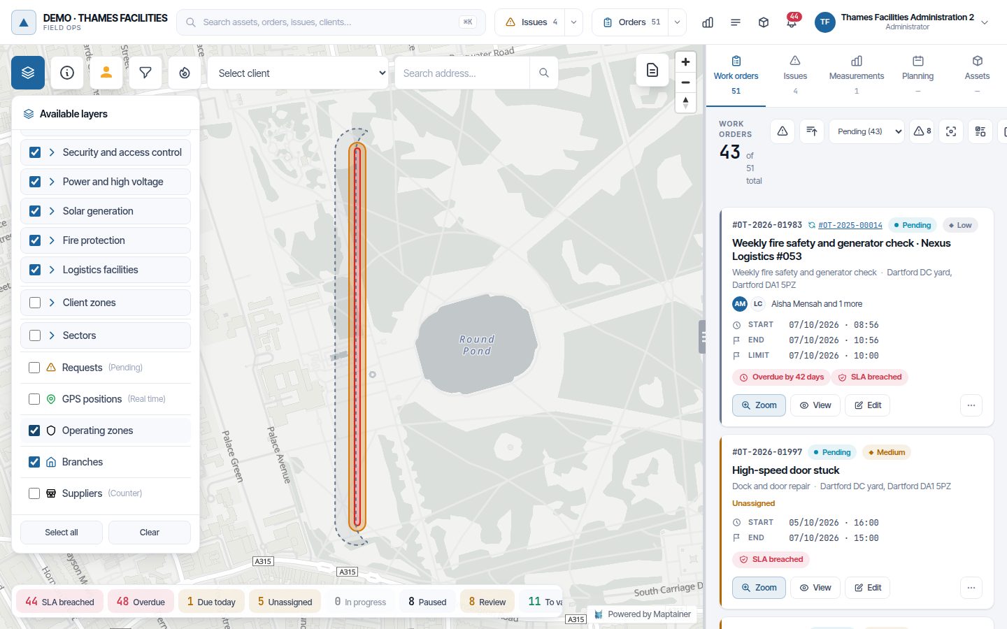
On the map, turn on the Operating zones layer. The colours show the most restrictive rule in force today:
| Colour | Rule |
|---|---|
| Red | No entry |
| Amber | Speed limit |
| Purple | Work not allowed |
Out of season, the zone is paler and has a dashed border. Click a zone to see its rules.
Incursions
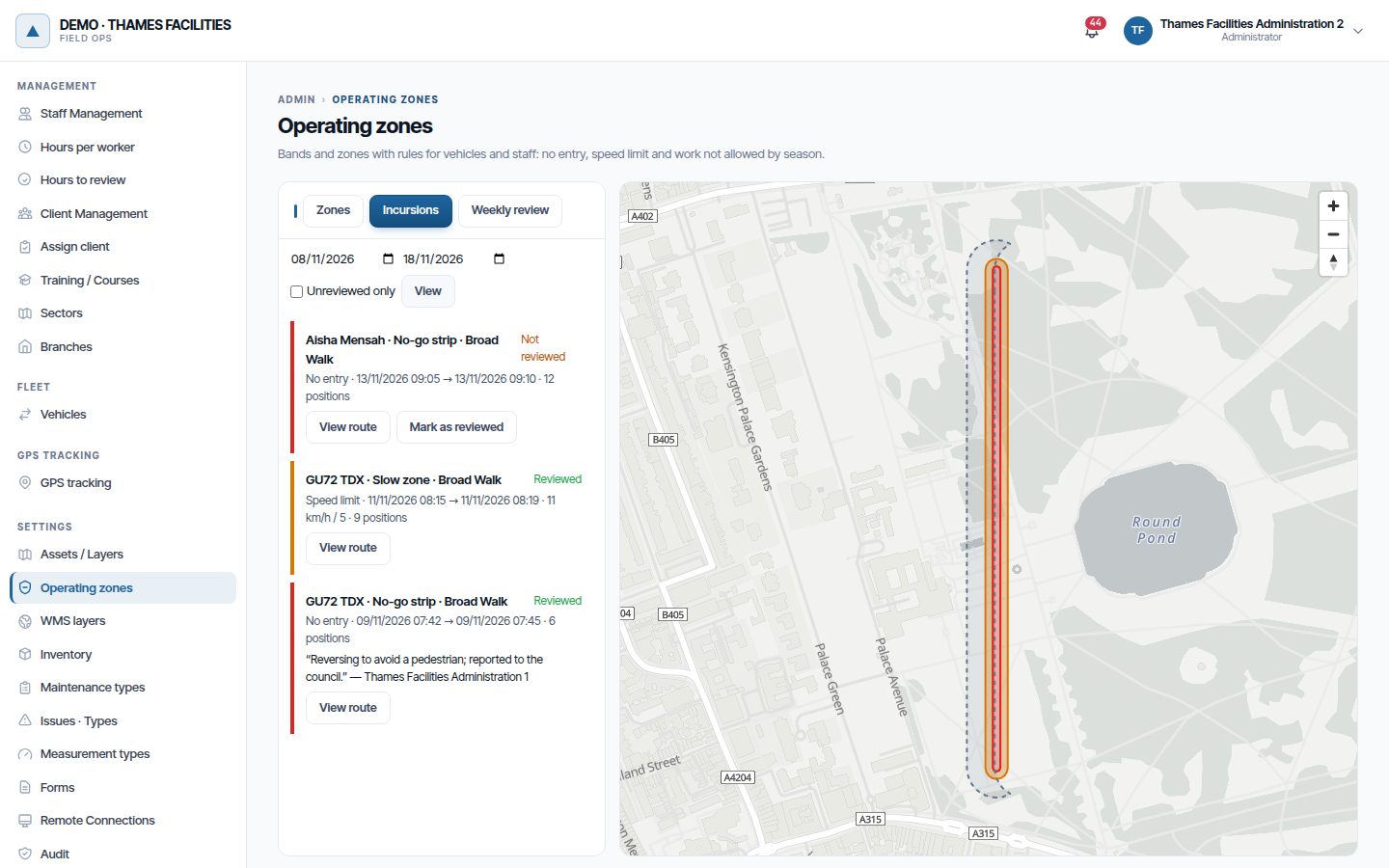
- In the administration area, click Operating zones, in the Settings group.
- Above the list of zones, to the left of the map, click the Incursions tab. The other two are Zones and Weekly review.
- By default it shows the last 7 days. Change the dates if needed and click View. Tick Unreviewed only to see what is pending.
- For each incursion: - View track draws on the map the positions before, during (in red) and after. - Issue opens the issue it created. - Mark as reviewed stores who reviewed it and a note.
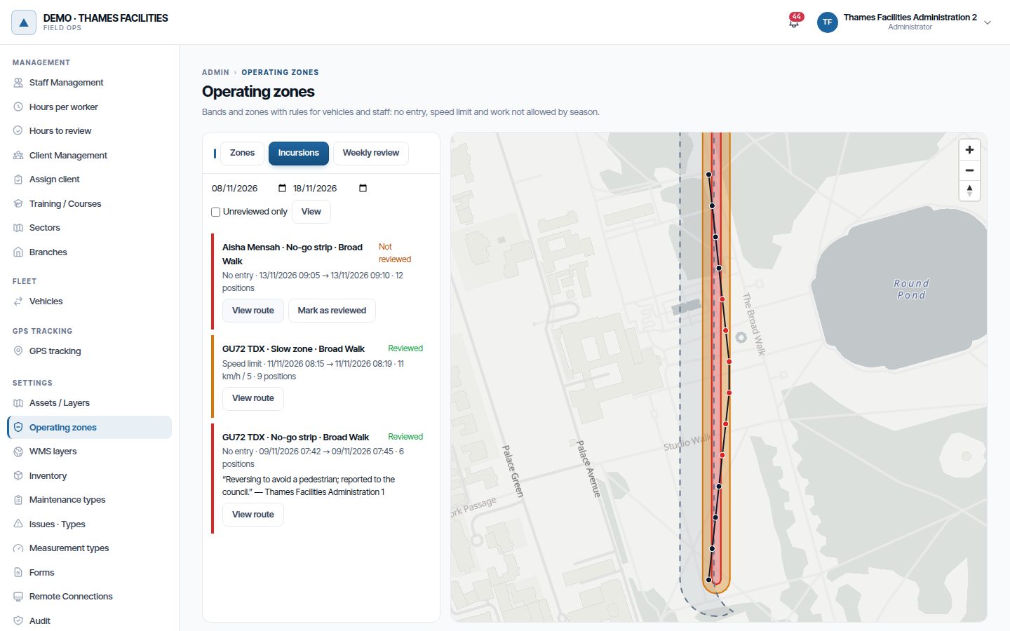
The alert of an incursion closes on its own when leaving the zone. The issue stays open for the foreman.
If the vehicle stops sending positions inside a zone, the incursion is closed at the last position after 10 minutes without signal.
Weekly review
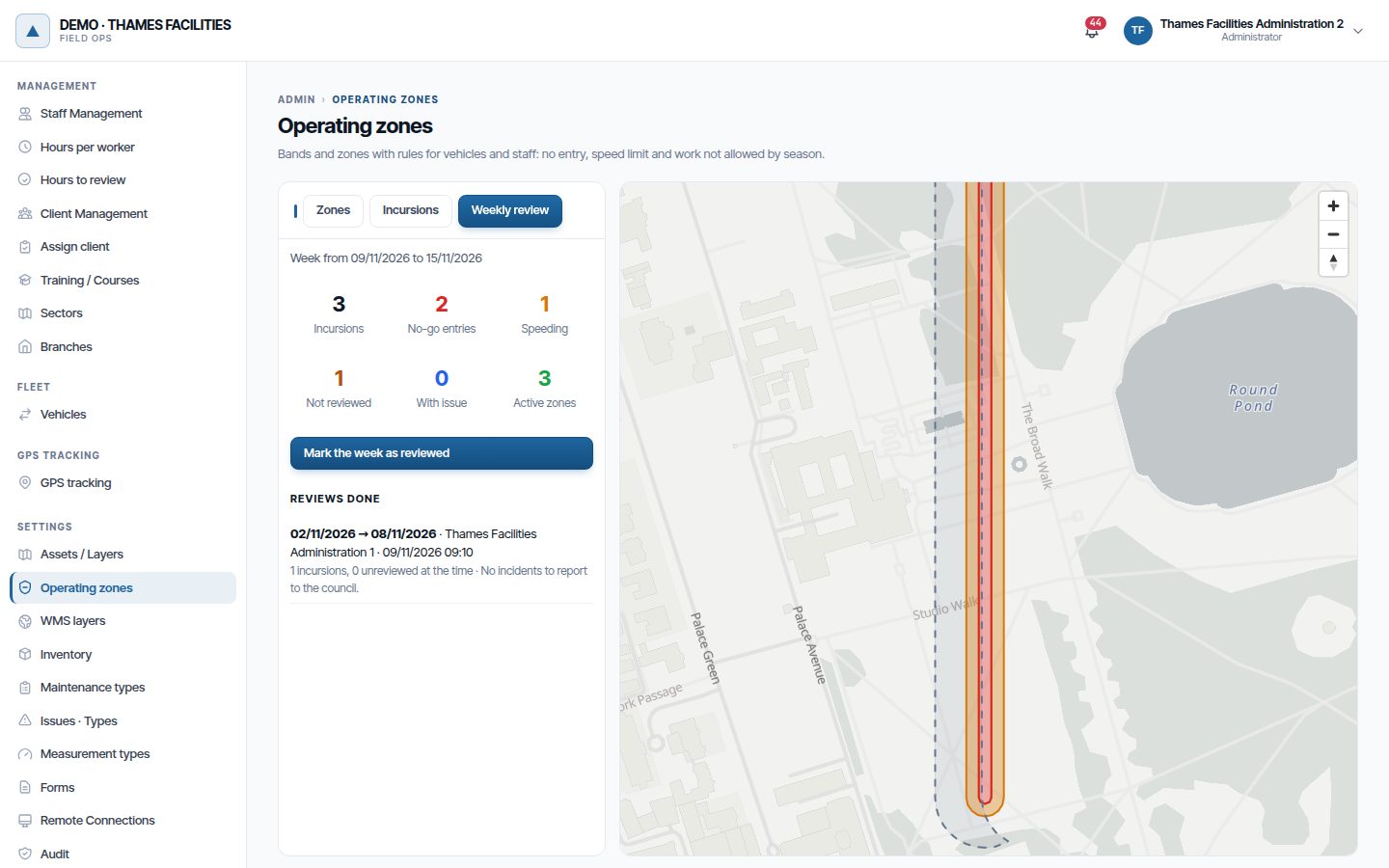
The Weekly review tab summarises last week: incursions, no-go entries, speeding, unreviewed and with an issue.
Click Mark the week as reviewed to record the check, even if there were no incursions. If there are unreviewed incursions, Maptainer warns you first.
Weekly report
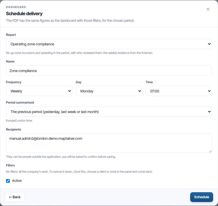
In the Dashboard, schedule a delivery and choose the Operating zone compliance report. The PDF includes:
- the summary of the period;
- who marked the period as reviewed and when;
- the list of incursions with their issue and their review.
Recipients can be outside the company, such as a council's technical department.
Work not allowed when planning
A Work not allowed rule is checked against the date, the location and the maintenance type of each work order:
| Rule | When creating a work order | When moving it in the calendar | When editing it |
|---|---|---|---|
| Alert | It is saved and an alert is raised | It is moved and an alert is raised | It is saved and an alert is raised |
| Block | It is not saved | It is not moved | It is saved and an alert is raised |
Work orders generated by preventive maintenance only raise an alert. The alert closes on its own if the work order leaves the zone or the season.
Zone settings
In Operating zones, click Settings:
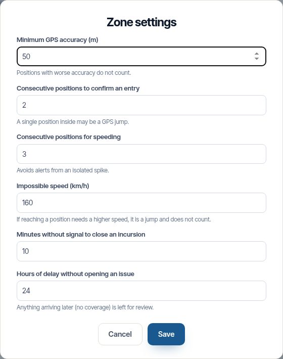
| Setting | Default | What for |
|---|---|---|
| Minimum GPS accuracy | 50 m | Positions with more error do not count |
| Consecutive positions to confirm an entry | 2 | A single point inside may be a jump |
| Consecutive positions for speeding | 3 | Avoids alerts from an isolated spike |
| Impossible speed | 160 km/h | Discards GPS jumps |
| Minutes without signal to close an incursion | 10 | Closes the incursion of someone who switches the GPS off inside |
| Hours of delay without opening an issue | 24 | Anything arriving late, without coverage, is left for review only |
In the mobile app
The app receives the day's zones in force to draw them on its map and warn the operator when approaching. The machinery's turning points are arrows with their orientation (road markings): they are shown already rotated on the web and in the app.
Frequently asked questions
Does a person walking along the strip generate an issue? Only if the rule applies to Staff or to Vehicles and staff. With Vehicles, staff on foot do not count.
What if the tractor has no coverage? The GPS stores the positions and sends them when the signal comes back. The incursion is recorded anyway. If it arrives more than 24 hours late, it does not open an issue and is left for review.
Can a zone be deleted? Only if it has no incursions. With incursions, it is deactivated.
Last updated: